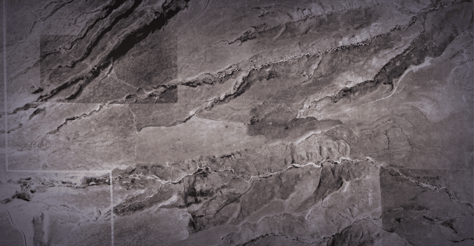
The Rocky Flats area, located 16 miles northwest of Denver, was once inhabited by Native Americans and then homesteaders and was used for grazing and mining.
Rocky Flats later became a critical part of the U.S. nuclear weapons complex during the Cold War. After World War II, the U.S. Atomic Energy Commission established facilities around the country to assist in the large-scale production of nuclear weapons, and in 1951, Rocky Flats was identified as one of these locations. From 1952 to 1994, Rocky Flats produced nuclear and nonnuclear weapons components for the nation’s arsenal.
In 1989, nuclear operations were suspended when the Federal Bureau of Investigation and the U.S. Environmental Protection Agency raided Rocky Flats to investigate reports of environmental violations. With the end of the Cold War, the site’s weapons-related mission ended in 1994.
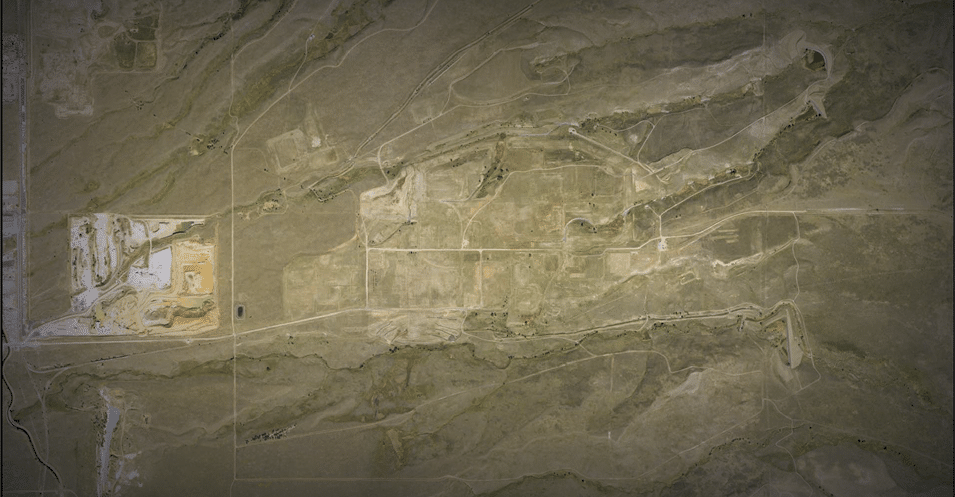
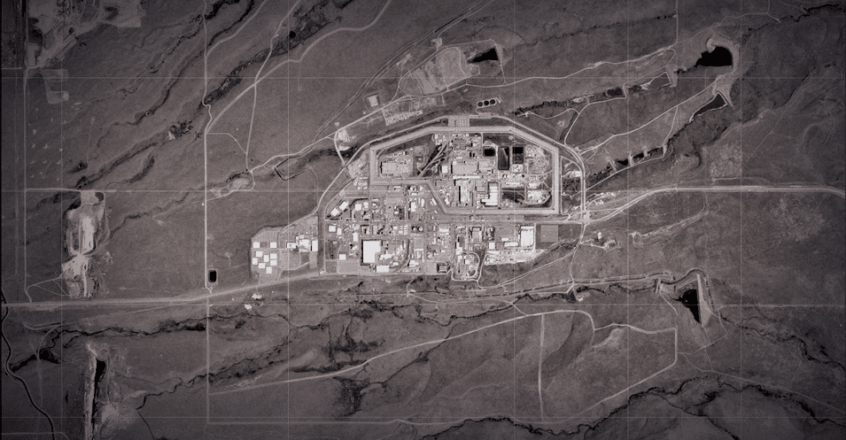
The new mission of the site was cleanup and closure. The U.S. Department of Energy (DOE) and its contractor completed a $7 billion cleanup in December 2005. More than 800 structures were demolished and removed from Rocky Flats. Radioactive waste and other materials were also removed from the site.
DOE’s Office of Legacy Management assumed responsibility for the remediated site in October 2005. In 2007, Rocky Flats was divided into two areas.
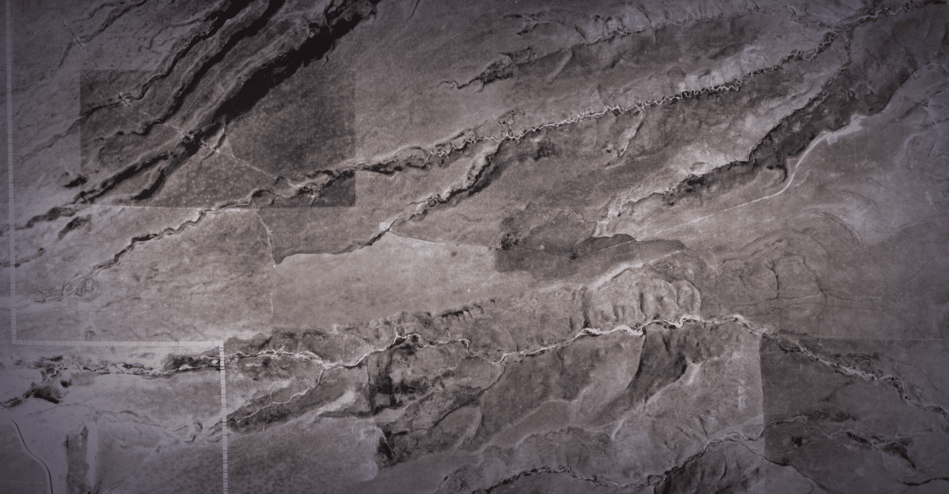
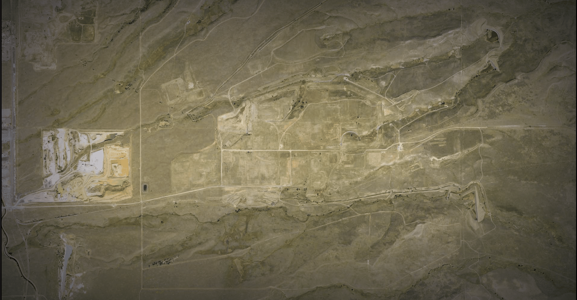
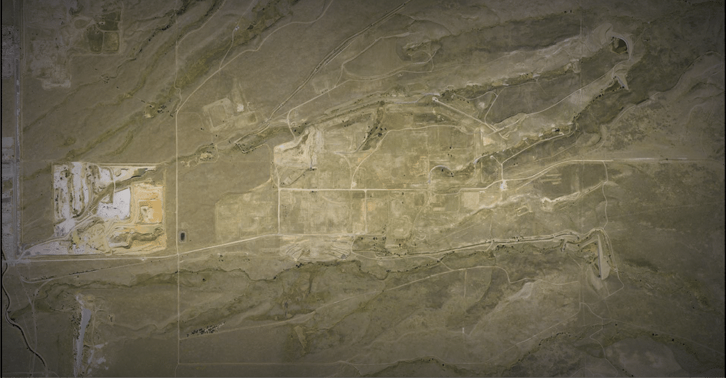
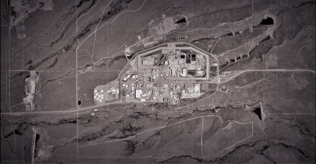
DOE retains responsibility for over 1,300 acres, known as the Rocky Flats Site or Central Operable Unit, including the former industrial and production area. DOE is responsible for monitoring, inspection, and maintenance of the Central Operable Unit, which includes groundwater and surface water sampling, ecological monitoring, and maintaining institutional and physical controls on-site. DOE complies with all applicable federal and state regulations, and water quality in the creeks leaving the site has remained below regulatory action levels.
Over 4,500 acres of the former plant’s security buffer zone was released for unlimited use and unrestricted exposure, which means that long-term surveillance and maintenance is not required. This area became the Rocky Flats National Wildlife Refuge, which is managed by the U.S. Fish and Wildlife Service.
For more information on the Rocky Flats Site, visit the site’s main webpage.


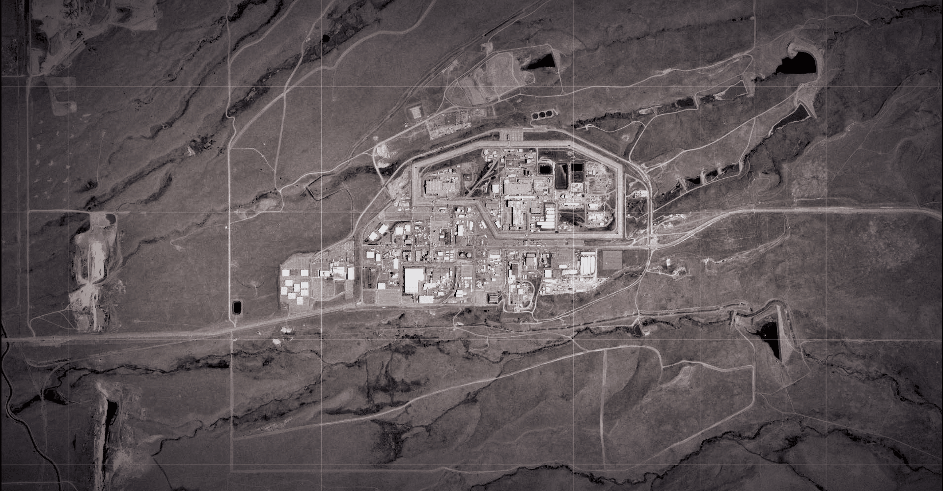


 = BUILDING 551
 = BUILDING 776
 = BUILDING 771
 = 903 Pad
 = CENTRAL AVENUE
 = COU ENTRANCE
 = EAST SHED
 = EAST TRENCHES PLUME TREATMENT SYSTEM
 = INTERCEPTOR TRENCH SYSTEM
 = LADY BIRD JOHNSON MEMORIAL FOREST
 = MOUND SITE PLUME COLLECTION SYSTEM
 = NOTCH
 = ORIGINAL LANDFILL
 = PRESENT LANDFILL
 = PRESENT LANDFILL TREATMENT SYSTEM
 = SOLAR PONDS
 = SOLAR PONDS PLUME TREATMENT SYSTEM
 = WEST GATE
 = WALNUT CREEK POINT OF COMPLIANCE
 = WOMAN CREEK POINT OF COMPLIANCE
LEGEND
The Rocky Flats area, located 16 miles northwest of Denver, was once inhabited by Native Americans and then homesteaders and was used for grazing and mining.
Rocky Flats later became a critical part of the U.S. nuclear weapons complex during the Cold War. After World War II, the U.S. Atomic Energy Commission established facilities around the country to assist in the large-scale production of nuclear weapons, and in 1951, Rocky Flats was identified as one of these locations. From 1952 to 1994, Rocky Flats produced nuclear and nonnuclear weapons components for the nation’s arsenal.
In 1989, nuclear operations were suspended when the Federal Bureau of Investigation and the U.S. Environmental Protection Agency raided Rocky Flats to investigate reports of environmental violations. With the end of the Cold War, the site’s weapons-related mission ended in 1994.


 = BUILDING 551
 = BUILDING 776
 = BUILDING 771
 = 903 Pad
 = CENTRAL AVENUE
 = COU ENTRANCE
 = EAST SHED
 = EAST TRENCHES PLUME TREATMENT SYSTEM
 = INTERCEPTOR TRENCH SYSTEM
 = LADY BIRD JOHNSON MEMORIAL FOREST
 = MOUND SITE PLUME COLLECTION SYSTEM
 = NOTCH
 = ORIGINAL LANDFILL
 = PRESENT LANDFILL
 = PRESENT LANDFILL TREATMENT SYSTEM
 = SOLAR PONDS
 = SOLAR PONDS PLUME TREATMENT SYSTEM
 = WEST GATE
 = WALNUT CREEK POINT OF COMPLIANCE
 = WOMAN CREEK POINT OF COMPLIANCE
LEGEND


The Rocky Flats area, located 16 miles northwest of Denver, was once inhabited by Native Americans and then homesteaders and was used for grazing and mining.
Rocky Flats later became a critical part of the U.S. nuclear weapons complex during the Cold War. After World War II, the U.S. Atomic Energy Commission established facilities around the country to assist in the large-scale production of nuclear weapons, and in 1951, Rocky Flats was identified as one of these locations. From 1952 to 1994, Rocky Flats produced nuclear and nonnuclear weapons components for the nation’s arsenal.
In 1989, nuclear operations were suspended when the Federal Bureau of Investigation and the U.S. Environmental Protection Agency raided Rocky Flats to investigate reports of environmental violations. With the end of the Cold War, the site’s weapons-related mission ended in 1994.
The new mission of the site was cleanup and closure. The U.S. Department of Energy (DOE) and its contractor completed a $7 billion cleanup in December 2005. More than 800 structures were demolished and removed from Rocky Flats. Radioactive waste and other materials were also removed from the site.
DOE’s Office of Legacy Management assumed responsibility for the remediated site in October 2005. In 2007, Rocky Flats was divided into two areas.
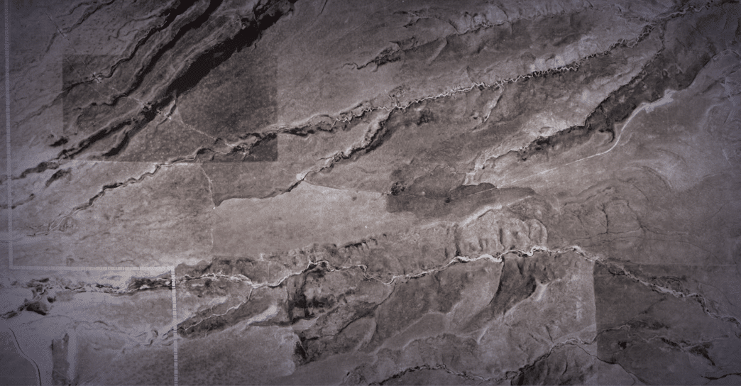
DOE retains responsibility for over 1,300 acres, known as the Rocky Flats Site or Central Operable Unit, including the former industrial and production area. DOE is responsible for monitoring, inspection, and maintenance of the Central Operable Unit, which includes groundwater and surface water sampling, ecological monitoring, and maintaining institutional and physical controls on-site. DOE complies with all applicable federal and state regulations, and water quality in the creeks leaving the site has remained below regulatory action levels.
Over 4,500 acres of the former plant’s security buffer zone was released for unlimited use and unrestricted exposure, which means that long-term surveillance and maintenance is not required. This area became the Rocky Flats National Wildlife Refuge, which is managed by the U.S. Fish and Wildlife Service.
For more information on the Rocky Flats Site, visit the site’s main webpage.


 = BUILDING 551
 = BUILDING 776
 = BUILDING 771
 = 903 Pad
 = CENTRAL AVENUE
 = COU ENTRANCE
 = EAST SHED
 = EAST TRENCHES PLUME TREATMENT SYSTEM
 = INTERCEPTOR TRENCH SYSTEM
 = LADY BIRD JOHNSON MEMORIAL FOREST
 = MOUND SITE PLUME COLLECTION SYSTEM
 = NOTCH
 = ORIGINAL LANDFILL
 = PRESENT LANDFILL
 = PRESENT LANDFILL TREATMENT SYSTEM
 = SOLAR PONDS
 = SOLAR PONDS PLUME TREATMENT SYSTEM
 = WEST GATE
 = WALNUT CREEK POINT OF COMPLIANCE
 = WOMAN CREEK POINT OF COMPLIANCE
LEGEND